Welcome to Life Images by Jill

Welcome to Life Images by Jill.........Stepping into the light and bringing together the images and stories of our world. I am a photographer, writer and multi-media artist.
Focussing mainly on Western Australia and Australia, I am seeking to preserve images and memories of the beautiful world in which we live and the people in it.

Welcome!

Welcome!
PLEASE CLICK ON THE IMAGE TO GO TO MY RED BUBBLE STORE.

Sunday 26 May 2013

Time out weekend - Margaret River, Western Australia.

This week we have a change of pace from the last few weeks of 4WD touring and bush camping in the eastern wheatbelt and southern goldfields - but I will be back to show you some more of this fascinating area very soon. 

Last weekend we had a time out weekend - a time to slow down, sit, walk in the bush, stroll on the beach, explore a couple of caves, do some wine tasting, eat out, and generally relax. 
Here is some late afternoon autumn light over the grape vines. The leaves are browning off now that the grape pick is done and late autumn is here. 


The place? Harmony Forest, a few kilometres along Sebbes Road, only about 16kms south of Margaret River in the heart of the spectacular Capes region of Western Australia.

The setting? Eight self contained cottages are set in natural bushland backing onto a vineyard. You really don't have to leave for the whole weekend if you don't want to!

Did we like it? Yes! Absolutely beautiful. The cottages, the location, the peace, the tranquility. All perfect. 

Below you can see what greets you when you enter the property. Can you see the little building in the middle RHS? This is "reception". Just open the door, pick up the phone, pick up the map, they tell you which cottage is yours, and where the key is. Simple! no fuss. 


Our cottage was beautiful. Set in Kari and Jarrah forest. There are only eight cottages on the property all separated by about 100 metres of bush. You can't see your neighbours at all - so very private. The cottages are beautiful inside and out. Oh my gosh, I love the light coming through these windows! I wish I had them at home!


You are free to walk along the bush tracks (varying length trails), and around the vineyard (although not through the vines as they are fenced by a very high fence to keep out the kangaroos). It is autumn here and so the vines are browning off and dropping their leaves. It would be fascinating to visit when they are harvesting the grapes for wine making. We sampled Harmony Forest's 2010 Private Select Merlo - beautiful - and bought another bottle to bring home with us.  Merlot grapes were first planted here in 1999. They currently supply grapes to some of the most respected wineries in the region. 

If you have the energy you can walk 8km along a sand track to the Boranup Gallery - a wonderful place to see local artisans exquisite work.But don't forget, you have to do the return 8km walk too!  Between the vineyard and our cottage was a little bridge through the trees and over the creek (middle RHS). Bottom left is a cockatoo feather I found.


Here are some kangaroos we saw when we went walking around the vineyard late one afternoon. You can see the high fence keeping them out of the vineyard on the right.


 On Saturday we had breakfast at the Lake Cave cafe (this was part of the package). And then walked it off exploring Mammoth Cave and Calgardup Cave - I will be back another day to tell you about the caves of the Capes.  We had a picnic lunch sitting on the beachfront at Prevelly - the surf was up! Afternoon tea at the gorgeous Voyager Estate (very elegant) (and just one of the many wineries dotted throughout the Capes) and then dinner that night at the Karridale Tavern (excellent food and good value for money - and only 10-15 minutes from our cottage). 


But for simplicity how about afternoon drinks at this spot.... (we saw this on our walk this morning)


I hope you have enjoyed this small taste of what the spectacular Capes region of the south west of Western Australia has to offer. The Capes spreads from Cape Naturaliste to Cape Leeuwin. It is home to many wineries, breweries, artisans, restaurants, the Cape to Cape walking trail, caves, The Leeuwin Naturaliste National Park, and a premier surfing region. There are many different accommodation options - from bush camping to 5 star - the choice is yours!

I am so lucky to have this very beautiful corner of our state within only a couple of hours from home. I will be back to show you some more another day.

To finish......the morning view from our porch at Harmony Forest........can you feel the peace and tranquility.........  


 Do you have a special place you like to go for a "get away from it all" weekend?

Thank you for stopping by dear reader. I look forward to hearing from you. 

I am joining wonderful contributors from around the world at Mosaic Monday, Our World Tuesday and Travel Photo Thursday. Please click on the links to see more - Mosaic Monday  
Our World Tuesday
Travel Photo Thursday 

 Want to find out more about Harmony Forest?  Please click on the link here - Harmony Forest  . I can thoroughly recommend Harmony Forest for a weekend getaway. (and no they are not paying me to say so!)

You can find out just about all you want to know about living and touring in Western Australia's south west by going to Jo Castro's fabulous site - ZigaZag - please click on the link here - Zigazag - Living in Western Australia


You may also like -please click on the links - 


The oceans edge - Yallingup, Western Australia
Walking the Capes - Cape Naturaliste, Western Australia


Monday 20 May 2013

Cave Hill, Burra Rock and the Woodlines, Western Australia

A couple of weeks ago I brought to you our trip along the Holland Track deep in the vast Great Western Woodlands south of the Coolgardie/Kalgoorlie goldfields in Western Australia. Click here if you missed it - Holland Track

If you have been waiting for the next part of the trip you are in luck - because here it is!
Today we continue our trip along the Woodlines to Coolgardie via Cave Hill and Burra Rock.

Leaving our last camp at Thursday Rock along the Holland Track, we headed east for about 21kms to Victoria Rock Road where we turned south for about 8kms, and then turned east onto the track leading to Cave Hill.

Victoria Rock Road is a well maintained dirt and gravel road that comes up from the Hyden Norseman Road to the south. (distance from Coolgardie to the Hyden Norseman Rd is approx 143km) However the track could possibly become boggy during winter and care needs to be taken to look out for washaways across the track.

Here is a pic I took along the Victoria Rock Road a couple of years ago. 


There are several 4WDrive-only tracks into Cave Hill but we turned at the official sign “Cave Hill 45kms”, rather than taking one of the earlier bush tracks marked by rough signs on corrugated iron.

There are bush tracks throughout this region known as “The Woodlines” – a network of hundreds of kilometres of abandoned railway formations south of the Coolgardie/Kalgoorlie goldfields. 4WDrivers can explore the area by following the old formations – however it is advisable to carry a GPS as amongst the network of tracks you could easily become lost.

 During the late 1800’s and early 1900’s timber cutters took hundreds of thousands of tonnes of wood out of this area to supply the goldfields with wood for structural timber for building and to shore up underground mining shafts as well as fuel for domestic use, locomotives and for steam engines which drove water pumping stations and electricity generators. 


The Western Australian Goldfields Firewood Supply Ltd was formed in 1899 and initially operated from the Kurrawang Siding 13km west of Kalgoorlie. Camps moved as wood was exploited. A main camp was located at Burra Rock between 1928 and 1932 as the woodlines snaked south. Cave Hill became the main camp between 1932 to 1938, followed by Lakeside, 4km south of Boulder.

It was wonderful to see how the Salmon Gum and Gimlet forests have naturally reforested. This area lays within the environmentally significant Great Western Woodlands which is preserved by Nature Reserves, Conservation Parks and National Parks. The Great Western Woodlands covers sixteen million hectares -  the largest and healthiest remaining Mediterranean climate woodland left on earth.


 Cave Hill is an impressive granite monolith – 1 kilometre wide and 1.5km long – rising 50 metres above the surrounding woodland. For thousands of years prior to European settlement, the Ngajtu Aboriginal people passed through this area and camped at Cave Hill so it is an important indigenous cultural site.

Explorer, Charles Cooke Hunt camped at Cave Hill in 1864 and named Cave Hill for the hollowed out wind sculptured cave on the western face. Hunt camped here several times during his attempts to penetrate the desolate region in search of permanent water supplies.  (in the picture above you might be able to see a "H" carved into the tree on the right of the bottom left photo - Did Hunt carve his initial on the tree? This was my start to a fascination with the history and explorations of Hunt). 


The cave is a one kilometre walk from the camping area or 30 minutes return – moderate difficulty. Visitors are asked to view the cave from the viewing platform due to the instability of the cave formation. Four catchment dams can also be seen which were constructed on the rock near natural depressions during the Woodlines era. Rainwater was diverted into the dams by stone slab walls cut from the rock. You can see one of the dams and a diversion wall below.


The camping area at Cave Hill was spacious with plenty of room to set up a camper trailer or tent. There is a drop toilet, tables and fire rings.  You can see the Cave Hill camping area in the image below -


 From Cave Hill there are two ways to get to Burra Rock approximately 40kms to the north. You can take the formed gravel road, or along the 4WD-only track (as we did) which follows the old railway tracks and embankments. The turn off is signposted. 

 
 As the track is slightly raised we didn’t seem to encounter the number of boggy sections as we did on the Holland Track but the track may be closed when wet. It was an attractive drive through the ribbon gums - Eucalyptus  Sheathiana – these eucalyptus trees shed their bark in long strips annually. The track is only one vehicle width and in places the scrub comes up to the edge of the track.  We stopped along the way for a lunch and to give the children a chance to run around. Along the way you may see evidence of the old railway

 
The Burra Rock campground is only about 200-300 metres from Burra Rock. The campground is open with plenty of room to set up and attractively located amongst eucalypts. There is a flushing toilet, picnic tables and fire rings, although please bring your own firewood and be aware of seasonal fire restrictions. 

Bush camping is a great way to introduce children travel, the environment and new outdoor experiences. They loved being able to run over the rocks exploring, and also learning about nature. But please do keep track of them! In the picture below you can see one of our children taking a close look at the lichen on Burra Rock. 

 
At the day use area at the base of the rock you will find interpretive panels and some old farming machinery from a small farm here in the 1960s. From here you can climb the rock to see the magnificent 360 degree views over the regrowth woodlands to Cave Hill.  Granite rock walls, built from granite slabs hewn on the site, direct rain water into a 11 million gallon dam.

It was a huge undertaking to build these walls. We read that to hew the slabs from the rock the men lit big fires on the rock and let them burn all night. The the morning the granite would be red hot. They carted tanks of water on a dray, and threw the water onto the rock. The rock would explode in big slabs which they could then sledge away. The slabs were stood on end to create the rock walls. As you can see in the image below, cemented together and propped up on one side by more rocks.

 
 Views from Burra Rock to Cave Hill. What a wonderful trip we had travelling and exploring with our family.


From Burra Rock it is 2WD 60km gravel/bitumen road to Coolgardie. But it was not the end of our trip.  I hope you have enjoyed this post, and will come back and visit again when I bring you the next part of our exploration through this part of Western Australia. 

I am linking up with Our World Tuesday and Travel Photo Thursday - please click on the links to see postings from contributors all around the world.
Our World Tuesday
Travel Photo Thursday 

MORE INFORMATION:
 
Facilities at Cave Hill & Burra Rock – toilet, tables, fire rings. Please be aware of fire bans and please take away all your rubbish with you.

Fees: Nil
Pets: not allowed
Cultural sites: Cave Hill and Burra Rock are important aboriginal cultural sites, so please respect these places.

For more information please click on the links:

Department Environment & Conservation - DEC campgrounds

Great Western Woodland - Gondwanalink– then go to “Achieving the Vision” tab and click on “Great Western Woodland”

Explore Oz – Explore Oz

An excellent guide book with GPS coordinates and notes on points of interest is - "Explore the Holland Track and Cave Hill Woodlines" by Nick Underwood. Explorer Series - Westate Publishing.

 You might also like:


Monday 13 May 2013

Paperbark cathedral - Leschenault Estuary, Australiand, Western Australia

Only about 5 minutes drive from our home is Cathedral Avenue which runs along the edge of the Leschenault Estuary at Australind.  Beautiful old paperbarks (which are natural to the area along the Estuary) arch over the old road like the roof of a cathedral. I love walking along here, and as it was a beautiful morning on Sunday we drove out to Cathedral Avenue for a walk. 
It is a great place for children to ride their bikes.


This was the original Old Coast Road. The road has now been diverted around this section, so you can walk or cycle along here quite safely. You can park at either the southern or northern end, and if you like walk both ways beneath the cathedral of trees or walk one way along the foreshore path, and then back through the trees.

In the bottom left picture, if you look into the distance, you might be able to see the Bunbury port facilities. It is so lovely to have a place to walk like this so close to home. I love the blue on blue effect of the top image. You can how the paperbarks cling to the edge. During winter storms they would be inundated by the rising water.


 The birds were enjoying the morning too - 
An eagle was fishing, swans were gliding, parrots were chatting, cormorants were sitting in their tree, pelicans were duck diving, and an ibis was stalking in the shallows.


and the kangaroos were looking, grazing and hopping. You often seen them in the paddocks along this stretch of road, so it is a good place to take overseas visitors (or city people!) to see kangaroos. 


On one side of the road is the Estuary, and on the other farm land. I often wish we had bought a block out here before it became a popular place to live and the prices skyrocketed. I would love to wake up in the morning and see the water and be able to walk along here every day. There are quite a few horse paddocks out here on the flat.


 I love the texture of the paperbark trees.   And surprisingly there are even a few olive trees. (although I took this pic last year - they are not fruiting at the moment)


Other good walks in this area are along the shores of the Collie River on either the Clifton Park side or the Eaton side, and also along the Leschenault Estuary waterfront and Collie River mouth at the Grand Canals.  

Do you have a favourite nature walk not far from you?

The Leschenault Estaury is popular for crabbing, fishing, prawning, boating, sailing and windsurfing. There is a boat ramp, car park, playground and public toilets are opposite the Australind shopping centre and numerous picnic and BBQ (wood) sites are scattered along the foreshore. 


The European history of Australind goes back to 1803.  

(Taken from the website of the Australind  Family History Society)

The Inlet on which present day Australind is located was named "Leschenault" by French Explorer Lieutenant de Freycinet, who charted the Australian coast in 1803 in the company of Nicholas Baudin. The land around Port Leschenault was explored by the Swan River colony's Surveyor General, John Septimus Roe, in 1830 and was further investigated by Lieutenant Bunbury in 1836

 After Captain Stirling began a settlement at Perth in 1829, a few settlers came to the Bunbury region from about 1831.
 However, in London in 1840, a town and farming enterprise was being planned, to be created at Australind. The company acquired some 103,000 and another 63,000 acres of land in the area.
 
To read more of Australind's history please click on the links -
the Australind Family History Society - Australind Family History Society
and Harvey History On Line - Harvey History Online

 You might also like -

Cathedral Avenue and Australind Pioneer Cemetary  
Dryandra Woodland in the early morning light
A walk in Yalgorup


Monday 6 May 2013

Holland Track, Western Australia - following the goldrush prospectors


We are just back from a five day 4WD and bush-camping trip along the Holland Track and through the "Woodlines" south of Coolgardie and the Western Australian goldfields.

As we sloshed, slid, crawled, bumped and rocked in the relative comfort of our 4-wheel-drive through the vast uninhabited mallee woodlands south of the Coolgardie goldfields I could not help admire the thousands of prospectors who had tramped these tracks over a hundred years before.   


When prospectors Bayley and Ford found gold at Coolgardie in September 1892 the goldrush brought thousands of prospectors to Western Australia. After landing in Fremantle or at Albany on the south coast they had to make their way overland through the harsh landscape to the goldfields.   

In April 1893 John Holland, an experienced bushman, Rudolph & David Krakouer and John Carmody, with five ponies and a light dray with provisions for 5-6 months, started a carefully planned expedition to cut a track in a north-easterly direction from Broome Hill to Coolgardie. The mammoth task took two months and four days to cut the 538 kilometre (330 mile) track through the dense bushland. Over the next three years 18,000 people used Holland's track until the Perth to Coolgardie railway line was completed. The track was also used by camel teams taking supplies to the goldfields and Holland operated a carting business along the track.

We had to carry all our food and water with us for our three day trip along the Holland Track, but I wondered how those early prospectors could have possibly been able to carry all their supplies for the several weeks it took to reach the goldfields, walking on foot with a pack, pushing wheelbarrows, riding horses or travelling on carts.  They may have shot or trapped wildlife along the way, and the track links granite outcrops where water can be found laying in gnama hole pools after rain. No doubt the trip claimed the lives of some who may now lay in unmarked graves along the track. 

The southern half of the track became incorporated into farmland in the 1920s and the northern part returned to bushland. 

In November 1992 Broome Hill farmer, Graeme Newbey, researcher Adrian Malloy and their group, with the aid of Graeme's tractor, succeeded in re-cutting the track from Wattle Rocks (about 22km north of the Hyden Norseman Road) to Thursday Rock (about 70km south of Coolgardie). In June 1993 Graeme led a 4WD expedition along the newly opened track to mark the centenary of Holland's historic journey. Since then the Holland Track has become a popular track for adventurous 4WDrivers. 


On our trip in late April, we joined the track at Newdegate. Heading north along the Newdegate North Road we turned off to visit Dragon Rocks where we had read you could still see the marks of prospectors carts on the rock. The rock was a convenient place to stop for lunch and after a bit of searching we are fairly sure we found what looked like wheel tracks. You can see them in the picture below.  


 From here it is a variety of gravel and sand tracks to the Hyden-Norseman Road, one section scouting around the edge of the salt lake, Lake Carmody, and passing through the State Barrier Fence (Vermin Proof Fence) - be sure to shut the gate to keep the emus out! 


56km east of Hyden along the Hyden-Norseman Road is the point where most people start the Track. Here you will find interpretive panels. 

Coming onto the Holland Track off the Hyden-Norseman Road - 


Once we started along the Track it became immediately apparent why the Track is best travelled during autumn and spring not during winter or after rain, and why you should travel with others. The track was a variety of mud, sand, rock and gravel and in places corrugated and tightly winding with scrub and trees right up to the edge of the track (impairing driver vision ahead), or hanging low over the track. We encountered numerous bog holes and deep muddy rutted sections which needed to be carefully and slowly straddled by our 4WD or can be avoided by following the go-arounds which in places have been pushed through the bush. You definitely need to take it easy and drive according to the conditions. Some of these bog holes are very deep and with the water in them you have no idea how deep they are. My husband stood in one dry wheel trench which came up to the top of his thigh!


You need to allow at least two days to cover the Track from Hyden to Coolgardie so be prepared to camp out. There are many places you can camp along the track - in small clearings or at any of the granite outcrops. There is also a campsite at Mt Holland and another one at Thursday Rock where there is plenty of room to set up, although there are no facilities. On our first night we camped in a small clearing about 30km from the Hyden Norseman Road and our second night at Thursday Rock about 21km from the Victoria Rock Road.

The top picture shows our camp at Thursday Rock and below left our first nights camp.

 
 You pass through a variety of vegetation along the Track. The track is only one vehicle wide so you need to be aware that you will have to pull off the track if another vehicle comes from the other direction. The scrub was quite often right up to the edge of the track, and often had very windy tight turns. We drove through vast areas that had been burnt by bushfire a few years ago - but it was pleasing to see how the bush was thickly regenerating.

I love these trees you see in the images below - they are called ribbon gums - Eucalyptus Sheathiana.  The ribbon gums replace their bark annually, as part of the normal eucalypt growth pattern. Other eucalypts strip their bark too, but not quite like the ribbon gum whose bark comes off in long tendrils. They are pretty to look at dancing in the breeze  and in a wind you can hear them clacking together.  The ribbon gum is found extensively through the eastern weatbelt, south of Wongan Hills to Norseman in the east. 


  And here are the flowers of the ribbon gum. I have just discovered this pic taken on a previous trip 


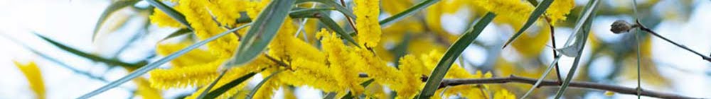
We weren't really travelling at the right time of year for wildflowers - but I have always said you will find something flowering somewhere. I nearly missed seeing these at the top of Mt Holland, and had to put my camera in the bush to photograph them. I think they are one of the pincushion hakeas, but I couldn't be sure. Their little parts uncurl out straight as they mature.


There are numerous granite outcrops along the way. If you are travelling with children the rocks are a great place to stop, stretch your legs, and explore. Our grandsons liked looking for tadpoles in the rock pool gnamma hole and had fun making tracks around the camp with their Tonka trucks or driving around the rocks.  But please do not drive your vehicle onto the rocks as it damages the delicate ecology and highly sensitive vegetation. We saw evidence of this where vehicles have destroyed delicate plant-life on the rocks.


  Rock gardens


My husband likes to photograph lizards and birds. This is an ornate dragon lizard. You see them darting over and under the rocks. They don't stay still for long!


Today the Western Australian Department of Conservation and Land Management (DEC) has jurisdiction over Great Western Woodlands, and maintains other tracks in the area for fire fighting. With support from DEC and Track Care WA Inc, the Toyota Land Cruiser Club (TLCC) has volunteered to maintain and upgrade the track. 


We had a great time exploring the Holland Track, had no problems other than a broken headlight protector, and we experienced perfect weather - beautiful days, no wind, and not cold at night.

How can you beat sunsets like these -


The second part of our trip took us via 4WD tracks through the Great Western Woodlands across to Cave Hill and then up along the Woodlines to Burra Rock for our third camping night, then onto Coolgardie, Gnarlbine Rock, where we saw another of Hunt's wells (see previous post (Exploring WA's wheatbelt), and then to Karalee Rock for our last camping night - but that will have to be another story.  


Some tips for the Holland Track - 

-  Distance - Broomehill to Coolgardie is approx 731 km
- This is a remote track, so usual preparations for remote 4WD track should be made, including carrying sufficient fuel, water, food, supplies, communication gear, spare tyres and puncture repair equipment, recovery gear, safety equipment and first aid, as well as emergency backup supplies. There are no fuel or food supplies between Hyden and Coolgardie.
- It is important to minimise impact on the track and environment - convoys are limited to no more than 10 vehicles at a time. 
- The Greater Western Woodlands is a very environmentally significant area - so please keep to the made track.
-  Avoid periods after heavy rain when there is a significant risk of bogging and track damage. Track can be impassable after heavy rain.
-  Recommended tyre pressure is 28-36 psi.
-  Only walk (no vehicles) over the environmentally sensitive granite rocks.
-  Camp only in established cleared areas.
-  Take all your rubbish away with you.
-    Best time to travel – autumn or spring (not during winter months or after rain).
-     It can be easy to become bogged so it is recommended that you travel with others.
-     A Hema or GPS tracker is very handy to plot your course. We found it very useful on the few occasions when we lost sight of the track around rocky outcrops.
-    When travelling in convoy a two-way radio is invaluable to keep in touch.
-    The track is one vehicle width, so be aware there may be oncoming traffic particularly on weekends or holiday periods. You might have to pull off into the bush to allow others to pass. 

-    Camper trailers are ok as long as they are built to handle off road conditions. Take the corners as wide as possible to minimise the risk of sidewall damage and keep in mind drawbar height when traversing bogholes. Do not tow a caravan.


More Information:
 A useful book - is "Explore the Holland Track and Cave Hill Woodlines" by NIck Underwood. Explorer Series - Westate Publishing.

I am linking up to Mosaic Monday, Our World Tuesday and Travel Photo Thursday. Please click on the links to see the work of other contributors around the world 
- Mosaic Monday
- Our World Tuesday

- Travel Photo Thursday

I hope you have enjoyed this little trip along the Holland Track. Do you go 4WDriving and bush camping? For one of my best friends this is the furthest from her idea of a holiday! How about you?


You might also like -
Exploring the Western Australian wheatbelt
Camp food
Living & Working on the Land - WA Wheatbelt